Taking photos is a passion for someone whereas sometimes it becomes a way to capture the priceless moments that will never back. Social networking websites like Facebook, Twitter, Instagram, etc. have really made the world crazy about clicking their photos whether with friends or just to change their profile picture. Also, these websites provide them a way to share their pictures with their friends which would have been impossible otherwise. Of course, no one is going to show these pictures to each one of his friends on his own. Tagging the location where the photos are being taken is another interesting feature nowadays. It’s normal for people to tag a place if they visit a very famous place like Eiffel Tower or go somewhere on a trip at a famous hill station. Our app for today has a similar feature. Let’s check it out.
I am talking about the latest Android app called GPS Map Camera (Google Map) that has been developed by JK. Fantasy. The app is compatible with all the devices running Android 2.2 or later version of the OS and therefore is almost compatible with any currently running Android Smartphone.
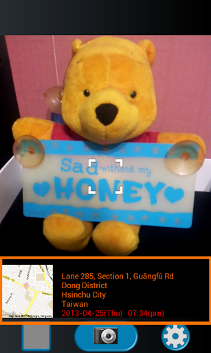
This is a camera app but as the name suggest, it has got something to do with GPS as well. Actually the app traces down your location as you take a photo and place your location on the map along with the address at the bottom left of your photo. But the user might not like taking all his photos with this map and address being pasted on it and that is why, when you click for the picture, two images are being saved to your photo library. One is with the map and address and the other is without it. This way, it’s your own choice on whether to keep both of them or not.
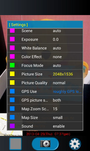
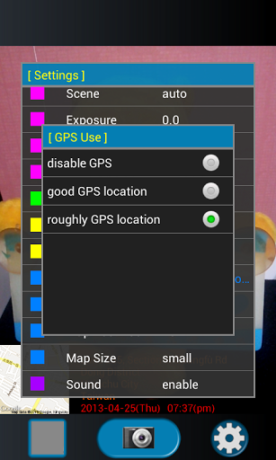
To locate yourself on the map, you must be connected to the GPS. To do that, first enable Wi-Fi connection on your phone. Then enable “use wireless networks” and “use GPS satellites” in “Location services” page. Once you’re connected, it will trace your location automatically. Other than this major feature, this camera app has many more features like different colour effects, white balance, map size, picture quality and you can also decide if you want both photos or not.
You can sort out the similar controls by the same colour so that if you want to change something about the Map feature, then you should also colour the GPS settings with the same colour as they both are directly connected. This sorting seems to be a little odd but can be useful as well for some users. But still it’s nothing that we can say to be obvious.
The app is available for free in the Play Store. So there is no harm if you can just once go and check this out.
Pros: integrated Google Maps feature; easy to use; customizable features; free.
Cons: nothing unique or hard hitting.
Apps400 Rating : * * * *
Download the App Here


