
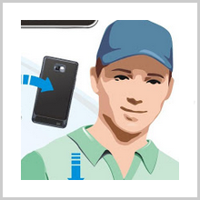
GeoLog is an application from SITIS, which helps save the GPS, magnetometer data and other sensor data from your mobile or any other device into a log file. It helps calculate the site coverage, which is nothing but a percentage expression of the ratio between the covering area of the track and the site area. The latest version, GeoLog 2, can even create sync with camera photos, thereby producing geophotos. These photos are seen with their geographic coordinates existing at the time of shooting. The application has access to your location, your network communication and your phone calls. The Global Positioning System or GPS, cell towers or Wi Fi is used by the application for getting the precise location. These services need to be turned on in order that the app can determine your location or position. The app can also access the phone features, to determine the identity of the device. The application can also write into the storage of the USB and write on the SD card.

Features
- The sensor date from your device can be recorded if it has a period of record that can be configured.
- A geofoto can be created by means of synchronizing the photos and the log.
- Several sites and logs can also be seen on the map simultaneously.
- You can also produce a PDF report with the app regarding the site coverage. The PDF report can contain two maps along with the sites and tracks selected, along with the data of the coverage, mentioning the name of the author.
- The sensors data can be logged from the device and can later be processed.

- Ordinary photos can be converted into geofotos.
- The site can be inspected and from the results, you can create reports. Search and Rescue operations can also be conducted based on the sensors data.
- The version 1.00.12421 requires Android of 2.2 or up.
- The size of the application is 860k.
- The application is also compatible with the Samsung GT-S7652.

The Good
The latest version offers a new interface for the application with all the previous bugs fixed. SAR operations, for instance, Civil Air Patrol can be managed and conducted easily. The data can be processed at leisure and site inspection can be reported. Even ordinary pictures can be converted into geo photos.
The Bad
You can only create a maximum of three projects. It is also possible to use only up to 3 logs in case of synchronization. If your device goes off into sleep mode, the sensors get turned off. In this case, the data does not get recorded into the log.

Summary
GeoLog is an Android application from SITIS that helps sensors data saving, such as compass and accelerometer or GPS, from your device on to a log file. The application is able to synchronize photos and logs and create a geofoto. A PDF report containing maps, sites, tracks, author’s name etc. can be created. Geographic coordinates for the photos are shown for your ordinary pictures.
Download the App Here


